Earthquake Hazard in Asia: A Growing Problem
Richard Walker is Professor of Tectonics at the Department of Earth Sciences, University of Oxford. He leads the Active Tectonics and Earthquakes Research Group, and is the Oxford lead of the UK Centre for Observation and Modelling of Earthquakes, Volcanoes and Tectonics.
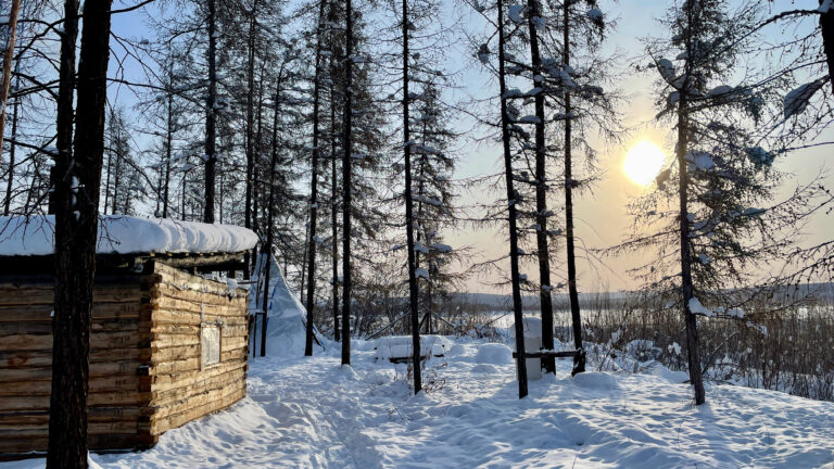
The desert town of Tabas-e-Golshan, eastern Iran, offers welcome respite from the heat of the surrounding plains. It is a green place with beautiful pleasure gardens and date plantations fed by underground canals that tap elevated water tables beneath the Shotori mountains, a snow-capped range that dominates the eastern horizon. The lush greenery is distributed between streets of neat modern brick houses, giving the town a very different appearance to when Sven Hedin stayed in the early 20th century, leaving a detailed photographic record of an ancient town with its citadel, minarets, wind towers, and narrows streets all of earthen construction.
The town has changed not because of gradual development but because on the 16th September 1978 it was completely destroyed by an earthquake of magnitude 7.3, which remains the largest in modern history to have hit Iran. The old town was levelled, and a new town built on top. Only a few water cisterns remain standing from before the earthquake because their design, with hemispherical domes that extend down to ground level, were able to withstand the shaking. Survivors from surrounding villages were rehoused amongst those few who survived in Tabas itself, and even today many of the outlying villages remain in ruins. The final death-toll of roughly 20,000 included about 85% of the town’s population at the time of the quake.
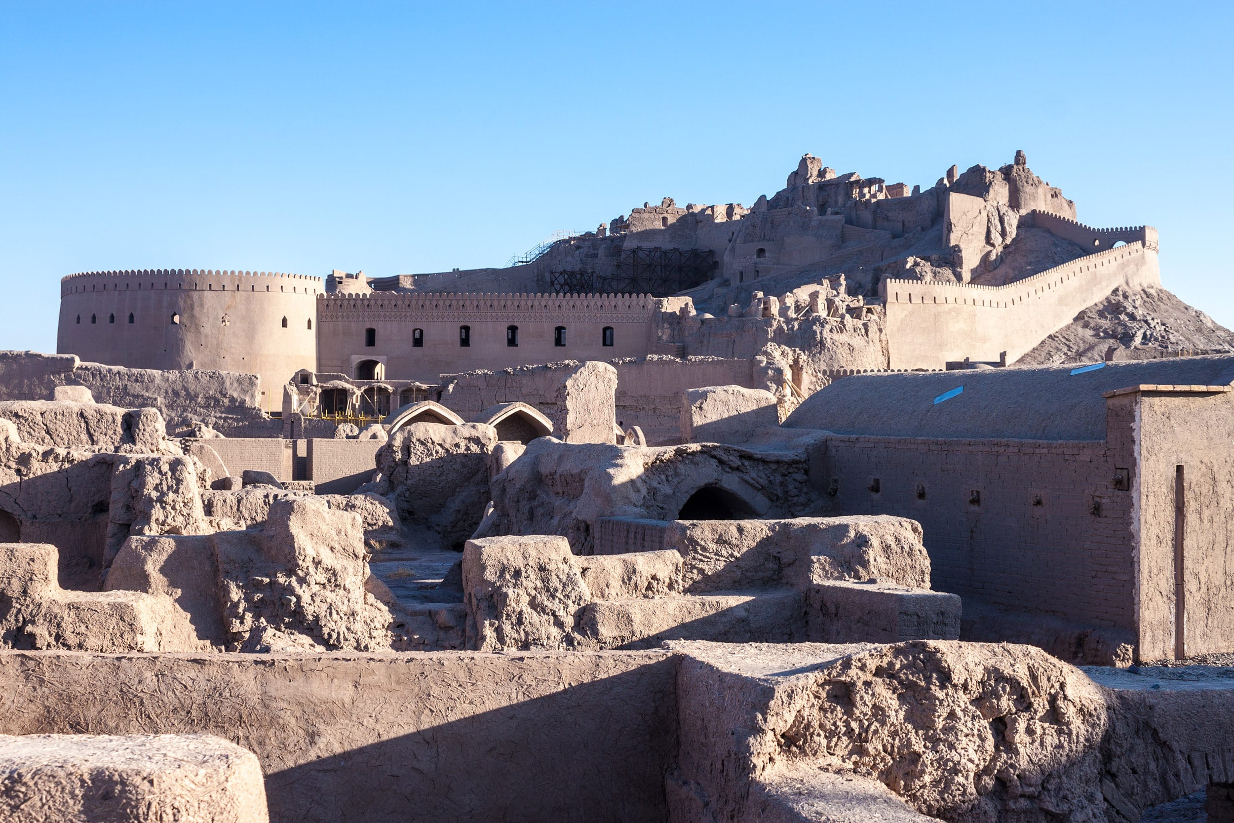
The story at Tabas is one that we have seen repeated many times over past decades, in countries from east to west across Asia, with historic population centres struck seemingly without warning. The 2003 Bam, Iran, earthquake is one example. It caused devastation in the town and surroundings, and badly damaged the UNESCO world heritage citadel (pictured above during reconstruction). More recently, the series of four earthquakes that struck rural areas close to the city of Herat, Afghanistan, in 2023 led to high fatality rates in villages close to the epicentre, with most of those killed being women and children, who were inside the houses when the first quake struck.
The 1978 Tabas earthquake was important scientifically, in that if was one of the first in which a direct link was made between the earthquake rupture and the long-term development of topography. A series of innocuous elongate hills to the east of the town, carved into Badlands by the strong winds, are now known to result from multiple repeated earthquakes, occurring over tens of thousands of years, that have each deformed and warped the earth’s surface by just a few metres. With hindsight we are able to identify Tabas as a zone of earthquake hazard, and by looking for similar landscape features elsewhere we can export our understanding, and gain a better appreciation of earthquake hazard regionally. An important development in our ability to identify active faults has come from the revolution in the availability of satellite imagery and detailed digital topographic datasets, which enable observations to be made regionally and at the appropriate scale.
Tabas, along with many other population centres in Iran and elsewhere in Asia, exists only because of the presence of a nearby fault. It is an unfortunate fact that population centres within the relatively arid parts of Asia correlate with regions most prone to earthquakes. Towns and villages are strung out along the alluvial plains, with uplands and towering mountains to one side and largely uninhabitable desert depressions on the other. The plains offer arable land for farming and, crucially, an availability of water for drinking and for irrigation. Year-round water supply comes from freshwater springs, or is tapped from groundwater sources under nearby highlands using ingenious underground canal systems. These water sources often exist because of geological faults that channel water flow along them to form springs, or form impermeable barriers to groundwater flow, causing elevated water tables that can be tapped.
It is the same geological faults that bring water that also move occasionally to produce earthquakes, with an interval of time between destructive earthquakes on any one fault that is measured in hundreds, or more commonly thousands, of years. When the faults rupture the shaking can have devastating consequences to populations living nearby, and for the survivors there is no option but to remain in place and rebuild, in a cycle that has continued for millennia. An important implication for the present day is that the distribution of large earthquakes measured using seismometers in recent decades gives only a partial story, and even very old towns and cultural heritage sites may still be at risk.
Some towns have grown by orders of magnitude over past decades. An example is Tehran, the capital of Iran, which has a population that has grown by two orders of magnitude over the past century. There are historical accounts of earthquakes in Tehran, and the now-urban landscape retains the tell-tale clues that reveal the presence of active faults within the city and along the margins of the nearby Alborz mountains. Similar things can be said for many cities from east to west across the continent. Xi’an in China, for instance, suffered the most devastating earthquake of all time in 1556, with over 800,000 deaths. Almaty, the largest city of Kazakhstan, was badly damaged by three earthquakes in the late 19th and early 20th centuries. Kabul, Afghanistan was badly damaged by an earthquake in 1505, a repeat of which would likely cause destruction and loss of life. There are many more examples, and many more cities at risk but with previous earthquakes that predate the historical record.
Across continental Asia there is also rapid development of infrastructure, ranging from energy pipelines, through road and rail networks, ports and terminals, and a rapidly expanding pool of planned hydropower and nuclear power facilities. Much of this development occurs in regions of unquantified earthquake hazard, but early mapping and identification of these hazards can help ensure resilient design.
There is, therefore, a need to understand where earthquakes may occur in future. Seismology and modern satellite monitoring technologies have an important role in these efforts. We continue to learn so much about the earthquake process from the scientific study of modern large earthquakes, and the overall distribution of seismicity helps to provide a probabilistic appreciation of how often large earthquakes may occur. But these methods alone do not provide the detail required to assess the potential impacts to specific towns, cities, and sites of major infrastructure. To gain this detail we must go further back in time to identify and better understand the sources of earthquakes that have occurred in the historical past, that may be represented in archaeological remains, or which have left an imprint in the landscape that can be read using satellite remote sensing and uncovered through field investigation.
The issues related to earthquake hazards may seem insurmountable, given the amount of growth that has occurred already. But we have an opportunity right now to increase resilience to earthquakes, both as new things are built and as what exists is adapted within our changing climate. Whether or not we seize that opportunity depends, however, on whether we invest the time to fully understand where the hazards lie.
The opinions expressed are those of the contributor, not necessarily of the RSAA.